Snowshoe hiking tour Hintere Mörsbachalm
gemiddeld Snowshoe hikes · Grimming-Donnersbachtal
Tourkenmerken
Conditie
Techniek
Tourinformatie
Parcours: 12.05 km
Duur: 04:45 h
Beklimming: 630 m
Afdaling: 630 m
Beste jaargetijde
Januari
Februari
Maart
April
Mei
Juni
Juli
Augustus
September
Oktober
November
December
De tour
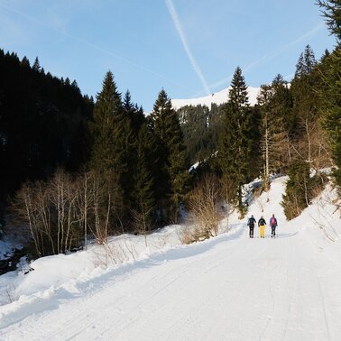
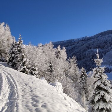
This hike really has everything included. A rustic stopover, enchanting winter wonder views and a comfortable and fast toboggan ride down into the valley. At the beginning of the tour, however, hiking and the use of poles is required. On a well-prepared winter hiking trail up to the Vordere and then on to the Hintere Mörsbachalm, where you can make wonderful loops in the snow-covered Almboden before returning to the valley.
Nadere informatie
Routebeschrijving
The tour starts in the center of Donnersbachwald. Passing the Hotel Stegerhof and the Pension Purkhardt, the ascent leads along the prepared winter path, which is also used for tobogganing, up to the Vordere Mörsbachalm, where the Mörsbachwirt invites you to stop for a bite to eat. From here the ski and winter hiking trail leads further south uphill to the Hintere Mörsbachalm. Towards the end of the valley, a beautiful alpine pasture area opens up to you. The way back is via the ascent route, whereby you have some shortcut possibilities down to the Vordere Mörsbachalm. At the Mörsbachwirt you can decide - either on foot or on two skids back to the valley. If you decide for the latter, host Theo has a rental toboggan at your disposal.
Start
Turn off the Ennstalbundesstraße (B320) at the crossing Trautenfels in direction Irdning, Donnersbach, Donnersbachwald. Through the village Donnersbach and another 12 km to Donnersbachwald.
Take the bus 941 to the stop "Donnersbachwald Ort". There you will also find the starting point of the hike.Bus timetable: www.verbundlinie.atThe closest train station "Stainach-Irdning" is about 22 kilometers away in Stainach.Train timetable: www.oebb.at
Parkeren
Free parking at the large parking lot in the center of the village
Start
Parking at the center of the village
Bestemming
At the starting point
Equipment
Before every snowshoe hike you should always check the current avalanche report - available at www.lawine-steiermark.at. Mountain sports and the assessment of the situation on site are - in winter all the more so - above all subject to personal responsibility. Tourism associations or avalanche warning services do not assume any liability based on information provided.
- Do not go on snowshoe hikes alone. Together it is more fun anyway.
- Always be aware of risks and react to danger signs.
- Observe existing regulations such as hunting and game reserves, reforestation or young growth areas
- You should always have your cell phone well charged. Have you also saved the emergency number 140 of the mountain rescue service? If you have no reception, take out the SIM card and dial 112.
- Always important: snowshoes, winter mountain boots or sturdy mountain boots as well as telescopic poles with snow plates
- In addition to food and warm drinks, pack spare clothing and a first aid kit in your backpack
- Choose your clothing according to the onion layer system
- An avalanche transceiver, probe and shovel are, as in ski touring, required in alpine terrain
- Use a backpack to which you can attach your snowshoes
- You should also pack maps and/or tour descriptions. GPX tracks on your cell phone or GPS device will also help you
- Rental of snowshoes, poles and safety equipment at Sport Scherz and Sport Schöttl
Tip van de auteur
Along this tour there are also other winter sports friends like ski tourers and tobogganists. Please take care of each other!
Overige informatie en links
Tourism information: www.schladming-dachstein.at
Tourism blog: www.derbergdastal.at
Tourist Office Schladming-Dachstein
Ramsauerstrasse 756
8970 Schladming
T: +43 3687 23310
Garbage on meadows and paths can not smell mountain and valley. Please take it with you. Agriculture and forestry are important partners for Berg und Tal. They allow you to walk and drive on many of their paths. Be aware that only good cooperation will guarantee your recreational enjoyment in the future.
Sport ScherzAt Riesneralm, Planneralm and in Wörschach+43 (0)3682 22383sport-scherz.atSport SchöttlAt Planneralm and in Irdning+43 (0)3682 22952 0sport.schoettl.at
GRIMMING-DONNERSBACHTAL Hike & Bike Map (1:31.000). Available free of charge at the tourist offices of Berg & Tal.SCHLADMING-DACHSTEIN Hike Map (1:50.000)
KOMPASS Map 68, Ausseerland-Ennstal 1:50.000, Hiking, Biking, Ski tours
Rother snow shoe guide Styria. The book is also available at the tourist office Grimming-Donnersbachtal for € 15,40.Dit kan ook interessant zijn voor u
Weersvooruitzichten
Datum kiezen
Snowfall and rain will persist into the afternoon, then the clouds will break up.
Partly sunny in the morning, gradually becoming cloudy in the afternoon.
A mixture of sunny periods and scattered snow showers.