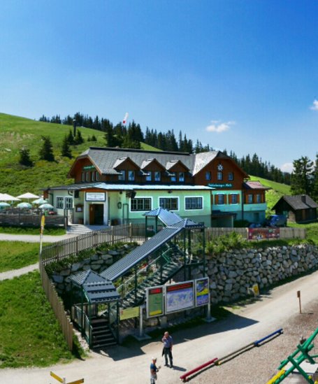
From Tetter Inn to Krahbergzinken summit
střední Summit tours · Schladming
After a break you follow trail n° 779 towards Krahbergzinken. Passing by the scree left from the medieval mining activities you reach one of the best view points of the region. Until Krahbergsattel you follow the way you came and then contine on trail n° 779 to the mountain terminal of Planai cable-car. You can choose whether you take the Planai panorama trail around the summit or extend for another 15 minutes to also cover the summit of Planai itself. From the mountain terminal take the cable-car back to Schladming.
If you are willing to walk downhill for another 2 to 2.5 hours and 1,100 meters in elevation you can also descend via one of several trails (numbers 50, 53, 55, 779) to Schladming.
- Buses of Planai-Hochwurzen-Bahnen: www.planaibus.at
Changes in weather patterns, quick falls in temperature, thunderstorms, wind, fog and snow are some of the dangers that can be encountered on a hiking tour. Hosts of alpine huts and mountain refuges have a lot of experience in the mountains and can give good advice about weather and the trails. Poor equipment, overestimation of one's own capabilities, carelessness, poor personal constitution and/or wrong judgement can lead to critical situations. In case of thunderstorms: avoid summits, ridges and steel ropes.
GPS data and orienteering
Available GPS data - just like hiking maps - is only a guidance for orientation and can never depict a trail exactly with all its details. Especially at dangerous spots it is essential to judge on site how to proceed.
In an emergency please call:
- 140 - for Alpine emergencies (all over Austria)
- 112 - European GSM emergency number
Information about bus schedules: www.planaibus.at
Information about cable-car hours: www.planai.at
- Hiking map ‘Hiking WEST’ available at the information offices in the region.
- Schladming hiking map, 1:25,000, available at the Schladming information office.
- Hiking map Schladming-Dachstein, 1:50,000, available at the information offices in the region.
- Hiking guide Schladming-Dachstein by Herbert Raffalt, available at the information offices in the region.


