Halserberg Tour

łatwe Hiking · Schladming

Charakterystyka wycieczki
Warunek
Informacje o wycieczce
Trasa: 6.29 km
Okres obowiązywania: 01:42 h
Wejście: 234 m
Zejście: 234 m
Najlepsza pora roku
Styczeń
Luty
Marzec
Kwiecień
Maj
Czerwiec
Lipiec
Sierpień
Wrzesień
Październik
Listopad
Grudzień
Wycieczka
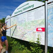
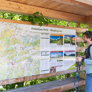
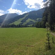
From the Steirerhof runs, shortly across the Vorbergstraße, the forest path with a wonderful view over the Schladminger Tauern, benches are inviting you to linger here. After a moderately sloping forest road, we walk uphill again. Near the Halseralm the way for the circumnavigation of the Halserberg branches off right. Here is the starting point for the Rittisbergrunde. The way continues across the forest and meadows, a forest path connects the Halserbergrunde with the Vorbergrunde. After a short time of walking we reach the free areas of Pichl-Vorberg. Along the streets we come back to our starting point.
Opis drogi
From the hiking trail head at Steirerhof you head North along Vorbergstraße until you reach the small residential area "Steirersiedlung". Here you make a left and follow the signs "Halserbergrunde" onto the forest trail. You walk along the South slope of Halserberg until you reach a trail  junction with a forestry road (leading up from Stoanerhof). You continue North towards Halseralm, where the tour joins Rittisberg tour. Here you make a right and continue East - along the edge of the forest you head back towards Vorberg. At a trail junction in the forest you make a right and after a couple of minutes walk through the forest you reach the hiking trail head Vorberg-Arnika. Make a right there and follow Vorbergstraße road back to your starting point at the trail head Vorberg-Steirerhof.
Przyjazd
Leave the highway B320 Ennstalbundesstraße in Pichl an der Enns and continue to "Vorberg" via the Vorbergstraße road until you reach hotel Steirerhof. The hiking trail head is situated straight ahead at the intersection.
The hiking trail head can be reached with bus lines 962 and 964 of Ramsauer Verkehrsbetriebe - bus stop "Steirerhof".

Bus schedule available at www.rvb.at

Parkowanie
The closest car parking is available at the trail head at pension Arnika.
Start
Hiking trail head Vorberg-Steirerhof
Cel
Hiking trail head Vorberg-Steirerhof
Equipment

Changes in weather patterns, quick falls in temperature, thunderstorms, wind, fog and snow are some of the dangers that can be encountered on a hiking tour. Hosts of alpine huts and mountain refuges have a lot of experience in the mountains and can give good advice about weather and the trails. Poor equipment, overestimation of one's own capabilities, carelessness, poor personal constitution and/or wrong judgement  can lead to critical situations. In case of thunderstorms: avoid summits, ridges and steel ropes.

GPS data and orienteering

Available GPS data - just like hiking maps - is only a guidance for orientation and can never depict a trail exactly with all its details. Especially at dangerous spots it is essential to judge on site how to proceed.

In an emergency please call:

  • 140 - for Alpine emergencies (all over Austria)
  • 112 - European GSM emergency number
Good walking shoes and custom-fit Nordic Walking poles are the standard equipment. We also recommend a belt for carrying a drinking bottle.

To też może Cię zainteresować

Prognoza pogody

Wybierz datę
rano
-4°C
w południe
0°C
wieczorem
-1°C
Frequent snowfall, maybe mixed with rain around noon.
rano
-3°C
w południe
0°C
wieczorem
-2°C
Dull throughout the day. Snowfall will increase more and more.
rano
-1°C
w południe
-1°C
wieczorem
-1°C
Thick clouds and widespread snowfall throughout the whole day.

Podobne wycieczki w okolicy