Dachstein Westridge (Westgrat)
Tour description
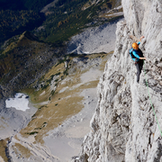
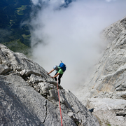
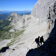
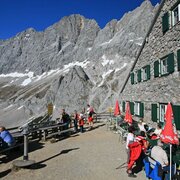
The Dachstein Westgrat Klettersteig up the Hoher Dachstein is often attemptedin combination with a crossing of the summit and descent via the Randkluftsteig or Schulter Klettersteig. A moderately difficult via ferrata in high-alpine terrain surrounded by extraordinarily beautiful landscapes, with access and descent across the glacier.
Comments:
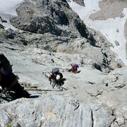
Vital when crossing the glacier - dangerous crevasses - crampons and ropes are essential.
Times:
- Via Ferrata - 1:00 h
- Time to Base - 2:00 h
- Time from Top - 2:15 h
- Total - 5:15 h
The tour
Map, elevation profile & further information
Approach:
Until just before the Seethalerhütte, then to the Steinerscharte (secured by stell cables in parts, rated up to level B), then descend on the west side to the Gosau glacier (with rungs and safety cables). From there, ascend heading south to the Obere Windluke, then left to the foot of the western ridge (start of the safety features).
Descent:
Descend via the Randkluftsteig, but only if the condition of the glacier crevasses permits. From ca. the beginning of August, you will have to descend via the Randkluftsteig and Schulteranstieg.
Arriving from the west:
From the west you can take the Munich-Salzburg motorway, continuing on the Tauern motorway (A 10) until the Ennstal junction. From here take the Ennstal A-road (the B 320) for around 30 km into the Schladming-Dachstein region, then take the Ramsau am Dachstein turn-off. Drive through the Ramsau Village and then turn left to Dachstein toll road. Continue up to the parking place Türlwand Hütte.
Arriving from the north:
From the south-east take the Pyhrnautobahn motorway (A 9) to the Liezen junction and then the Ennstal A-road (B 320) into the Schladming-Dachstein region. Then take the Ramsau am Dachstein turn-off. Drive through the Ramsau Village and then turn left to Dachstein toll road. Continue up to the parking place Türlwand Hütte.
Parking lot at the bottom station of the Dachstein glacier cable car
Trip Planner Bus Stop: Türlwandhütte
Hiking Via Ferrata routes is a demanding sport in rugged terrain. For your safety, please observe the following rules:
- Via Ferrata routes are demanding and require a good level of fitness, no hight vertigo and sure-footedness.
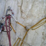
- Always use a helmet and, a Via Ferrata kit to attach yourself to the safety rope. Many mountain rescue missions are a result of carelessness and bad weather conditions.
- Many routes require most of the day. When planning a tour, always include the possibility of a sudden change of weather. Be prepared: carry spare clothing and a good stock of food supplies.
- Always show respect towards fellow mountaineers. Inform them about possible dangers if need be.
- Take care of our environment. Only take photographs and memories with you - leave no trace.
Alpine Emergency Numbers
Mountain rescue 140
Euro Emergency Call 112
Via ferrata equipment, Glacier equipment
Latest Informationen at Bergführerbüro Ramsau am Dachstein or phone +43 664 522 0080.
www.via-ferrata.de
Sommerfreizeitkarte WEST - available in all information offices of the TV Schladming-Dachstein
Alpenvereinskarte Nr. 14 - Dachsteingebirge
KOMPASS Karte 031 Der Dachstein, Ramsau, Filzmoos - available in Information office Ramsau am Dachstein
Klettersteige (Via Ferratas) - Atlas Österreich Schall Verlag - only in German
Via Ferratas English- TV Schladming-Dachstein (You will find the pdf file under "Klettersteige")


