Haus-Aich
Mountain hike Petersberg
Winter walking
Data:
Tour description
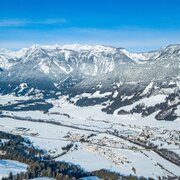
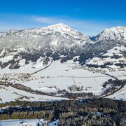
Past a road with magnificent panoramic views with traditional mountain farms, along a cleared mountain road with little traffic at approx. 1.000 metres above sea level above the Enns valley.
The tour
moderate
publicly accessible
Starting and end point
near by Aignerhof at Petersberg
Tour characteristics
Fitness (3/6)
Skills (2/6)
Information
Distance: 5.92 km
Duration:
2 h
Ascent: 263 m
Descent: 263 m
highest point: 1185 m
Best season
Jan
Feb
Mar
Apr
May
Jun
Jul
Aug
Sep
Oct
Nov
Dec
Map, elevation profile & further information
Drive by car near to the Aignerhof on the Petersberg. From there the hike leads slightly uphill, past the traditional mountain farms such as Schwarzkogler, Poser or Pölz to the end point Schwaigerhof at Petersberg. Return route as outward route.
Ennstalbundesstraße (B320) - Ruperting - direction: Niederberg/PetersbergAlong the path at pushed out parking bays.
Arrival with the Postbus (L900) is only possible until Ruperting!
In winter, caution is advised even on seemingly easy hikes. In shady areas, the ground can be slightly icy, and there may be avalanche danger below slopes. Mountaineering is therefore primarily a matter of personal responsibility – even more so in winter. Tourist associations and avalanche warning services assume no liability whatsoever based on the information provided.
Your equipment should ideally include:
Your equipment should ideally include:
- Ankle-high, warm shoes. Waterproof, warm shoes with a treaded sole are ideal. Optional: Gaiters for additional snow protection.
- A hood and warm clothing, ideally layered. Don't forget a change of clothes for longer winter hikes: a wind and waterproof jacket and trousers.
- A small backpack with a warm drink in a thermos and snacks as needed
- Sun protection
- Cell phone
- First aid kit
- Optional: crampons/snow spikes (snow chains for shoes), telescopic hiking poles for better grip and balance.
Enjoy the incredible panoramic view of the Dachstein massif.
Tour at your own risk! No liability is accepted for any alpine dangers (weather, etc.) that may occur. Weather changes, rapid drops in temperature, thunderstorms, wind, fog and snow fields are objective dangers and require the correct behaviour on the way. In an emergency, please dial the following emergency numbers:
No. 140 - for alpine emergencies - Austria-wide
No. 112 - Euro emergency call GSM emergency call service


